Census and register counts move from administrative zones to a fine equal-area grid, to buildings and to any target polygons. Seven methods, from areal weighting to building-based allocation and pycnophylactic interpolation, keep every zone total exactly; an accuracy page compares them and a self-contained HTML report names every formula, data source and licence.
Version: 0.1.1QGIS: 3.28+ / 4.xLicence: GPL-2.0-or-laterDeveloper: GeophiloLanguage: English
01 · Overview
What 02Dasymetric does
Census and register counts move from administrative zones to a fine equal-area grid, to buildings and to any target polygons. Seven methods, from areal weighting to building-based allocation and pycnophylactic interpolation, keep every zone total exactly; an accuracy page compares them and a self-contained HTML report names every formula, data source and licence.
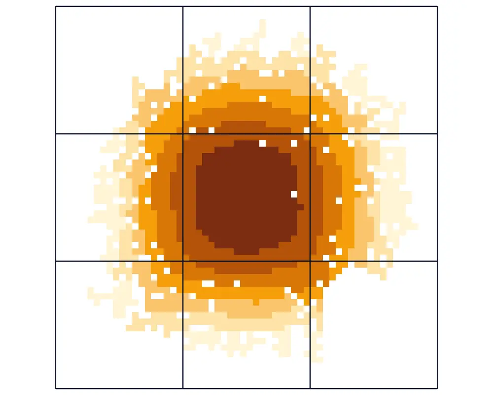
A population surface of the demo city on the working grid, disaggregated from the nine 2 km source districts (outlined).
Zones and grid
Exact zone totals
An equal-area working grid (UTM inside one zone, Lambert azimuthal equal-area otherwise) and supersampled zone fractions, so every method preserves each zone total.
Ancillary data
Buildings, built-up, land cover
Building footprints by count, footprint, floor area or volume; GHS-BUILT-S/V, GHS-POP, WorldPop and ESA WorldCover fetched on request with size, licence and DOI recorded; or any local raster.
Accuracy
Methods compared
Validation against finer zones, aggregate-up self-validation and agreement with a population prior; RMSE, MAE, bias, MdAPE, R squared, misallocated share and a per-cell method spread map.
02 · Install and quick start
Install, then run the demo
In QGIS, open Plugins › Manage and Install Plugins, search for 02Dasymetric and install it, or install a release zip with Install from ZIP.
QGIS 3.28 or later (QGIS 4 included). Only qgis.core, GDAL, NumPy and PyQt are used; SciPy is used for non-negative least squares when present, and a built-in solver gives identical results without it. GHSL, WorldPop and WorldCover downloads happen only on request, through the QGIS network settings.
Click the 02Dasymetric toolbar button; the lab opens as a dock on the right.
Load the demo city
On Zones, press Load demo city: 9 districts of 2 km with 143 313 people, 36 neighbourhoods with the true count, 5 942 buildings, a built-up raster, a population prior and a land-cover raster, in EPSG:32635.
Run the methods
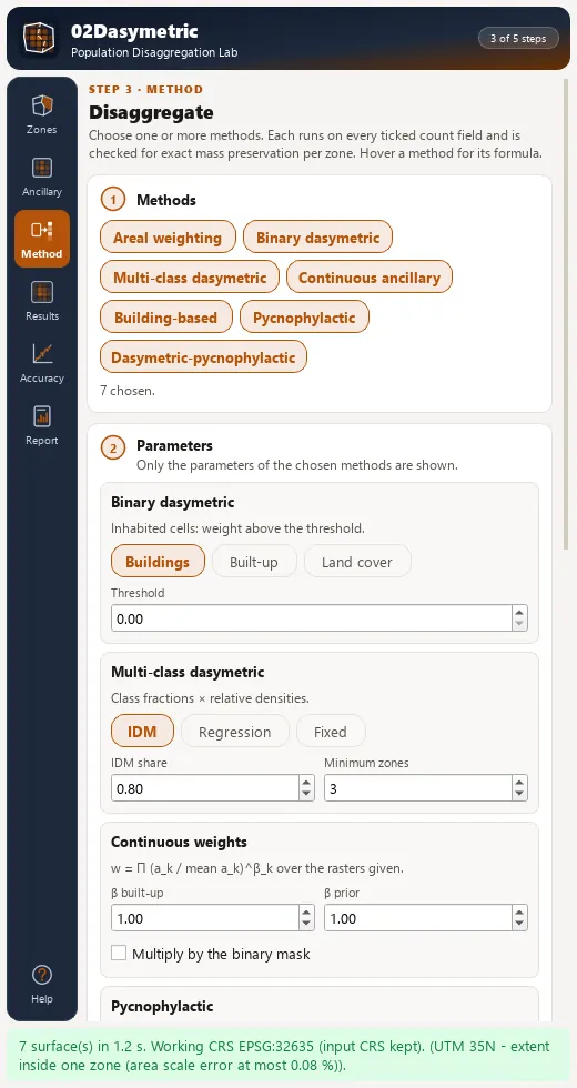
On Method, press Run disaggregation: all seven methods in about a second.
Assess
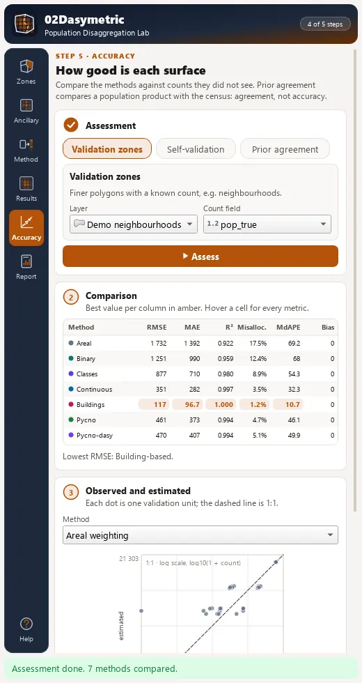
On Accuracy, choose Validation zones and press Assess. RMSE per neighbourhood ranges from 117 (building-based) to 1 732 (areal weighting).
03 · The dock
The lab dock, page by page
The lab is a dock on the right of the QGIS window with an icon rail of 6 pages and Help. Long steps run as QGIS background tasks with a progress bar and a Cancel button.
Page
What it holds
1. Zones
Source zones, key and count fields, cell size and supersampling, a working CRS badge and Load demo city with planted truth.
2. Ancillary
Buildings with weight, filter expression and minimum area; built-up, population prior and land cover from a fetch or a local raster, with an editable class weight table.
3. Method
Areal weighting, binary, multi-class (fixed, intelligent dasymetric mapping or regression densities), continuous weights, building-based allocation, Tobler pycnophylactic and the dasymetric-pycnophylactic hybrid.
4. Results
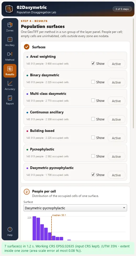
One GeoTIFF layer per method, a histogram of people per cell, quantile styling, class densities, building and target summaries.
5. Accuracy
A comparison table with the best value per column marked, an observed-against-estimated scatter and an error layer.
6. Report
HTML report, GeoTIFF per method and a method-spread GeoTIFF, GeoPackage and a CSV of checks and metrics.
Method page of the 02Dasymetric dock after a run, listing mass error and inhabited cells per method.Results page with one population surface per method and a histogram of people per cell.Accuracy page comparing the methods against validation zones.
04 · Processing
Processing provider
The plugin registers a 02Dasymetric provider with 15 algorithms in the Processing Toolbox, usable in models, batch mode and scripts.
Every analytical engine in 02Dasymetric pairs with standalone, MIT-licensed pure-Python packages in the 80-SDK Geophilo ecosystem (Areal Interpolation, Demographics & Coordinate Grids) for reproducible notebooks, batch pipelines and automated testing.