Quantitative urban morphology in QGIS. Building footprints, and optionally street centre lines, heights and a study limit, go through morphological or enclosed tessellation, 63 primary characters at five scales, contextual characters, principal components and clustering to an urban-fabric typology with type cards, a categorised map and a self-contained HTML report.
Version: 0.1.1QGIS: 3.28+ / 4.xLicence: GPL-2.0-or-laterDeveloper: GeophiloLanguage: English
01 · Overview
What 02Morphometrics does
Quantitative urban morphology in QGIS. Building footprints, and optionally street centre lines, heights and a study limit, go through morphological or enclosed tessellation, 63 primary characters at five scales, contextual characters, principal components and clustering to an urban-fabric typology with type cards, a categorised map and a self-contained HTML report.
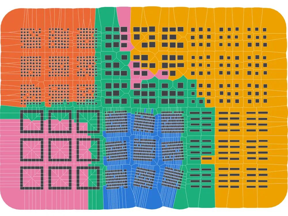
The demo town after the whole chain: tessellation cells coloured by the urban-fabric type found by clustering; building footprints on top.
Tessellation
Cells around every building
Morphological tessellation (Voronoi cells of densified footprint outlines inside a buffer or a limit polygon) or enclosed tessellation inside the blocks formed by a street network.
Characters
Five scales, documented
Dimension, shape, distribution, intensity, connectivity and diversity measures for buildings, cells, blocks, street segments and street nodes; each with formula, unit and reference.
Typology
Clustering with diagnostics
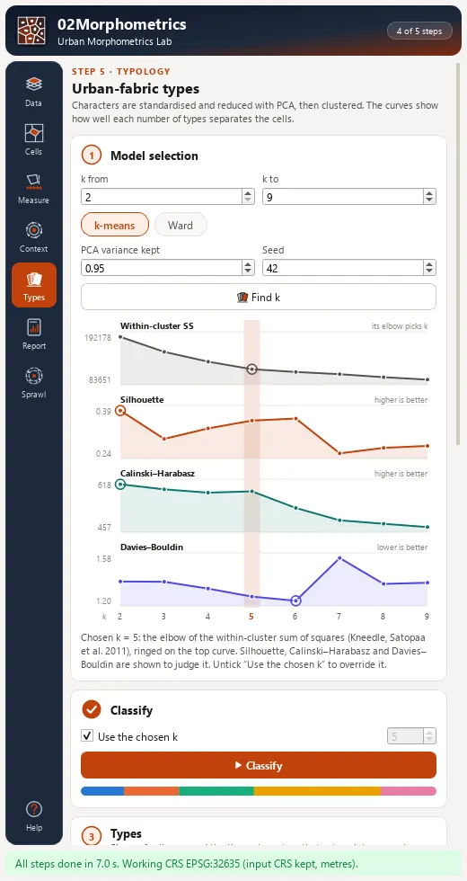
Standardisation and PCA, k-means or Ward; the elbow of the within-cluster sum of squares picks k, with silhouette, Calinski-Harabasz and Davies-Bouldin curves to judge it.
02 · Install and quick start
Install, then run the demo
In QGIS, open Plugins › Manage and Install Plugins, search for 02Morphometrics and install it, or install a release zip with Install from ZIP.
QGIS 3.28 or later (QGIS 4 included). NumPy ships with QGIS; SciPy is used for a faster nearest-neighbour search when present, with identical results without it. Nothing else is installed.
Click the 02Morphometrics toolbar button; the lab opens as a dock on the right.
Load the demo town
On Data, press Load demo town: about 1 700 buildings with heights, a street grid and a limit polygon in EPSG:32635, laid out as six planted fabrics.
Run all steps
Press Run all steps; on a desktop machine this takes a few seconds.
Read the result
Open Typology for the type cards and the diagnostics, then Report to write the HTML report. With default settings the demo gives five types (adjusted Rand index 0.82 against the planted fabrics).
03 · The dock
The lab dock, page by page
The lab is a dock on the right of the QGIS window with an icon rail of 7 pages and Help. Long steps run as QGIS background tasks with a progress bar and a Cancel button.
Page
What it holds
1. Data
Building layer, optional streets, limit polygon, id and height fields; a badge shows the working CRS and why it was chosen. Load demo town adds a synthetic town with six planted fabrics.
2. Tessellation
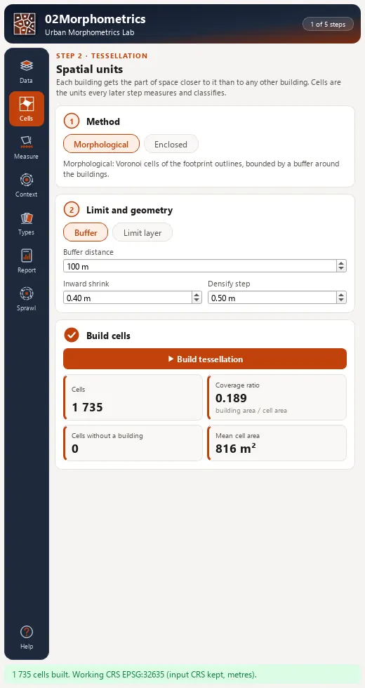
Morphological or enclosed mode, limit buffer, inward shrink and densification step; KPI cards for cells, coverage ratio and cells without a building.
3. Characters
A searchable checklist grouped by level and category with presets (Core 20, Full, Shape only, Street & network) and a distribution bar per character.
4. Context
Queen or rook contiguity, neighbourhood order k and statistics: mean, median, IQR, IDR, Simpson, Theil, Gini.
5. Typology
k range, k-means or Ward, PCA variance; Find k draws the diagnostic curves, Classify fills the type cards and styles the cells. Every cell carries cluster_margin.
6. Report
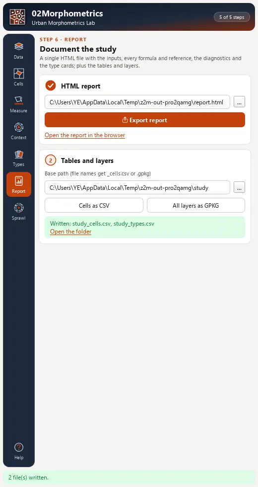
Self-contained HTML report, CSV and GeoPackage export of every layer and a per-type table.
7. Sprawl
Footprints rasterised around a centre: built share, patches, share of the largest patch, density gradient and built share in concentric rings.
Tessellation page of the 02Morphometrics dock.Typology page with the within-cluster sum of squares, silhouette, Calinski-Harabasz and Davies-Bouldin curves.Report page with HTML, CSV and GeoPackage export.
04 · Processing
Processing provider
The plugin registers a 02Morphometrics provider with 12 algorithms in the Processing Toolbox, usable in models, batch mode and scripts.
Group
Algorithm
Tessellation
Morphological tessellation
Tessellation
Enclosures (street blocks)
Tessellation
Enclosed tessellation
Characters
Building characters
Characters
Cell characters
Characters
Block characters
Characters
Street segment characters
Characters
Street node characters
Context
Contextual characters
Typology
Urban fabric typology (classify)
Typology
Urban morphometrics lab (whole chain)
Report
Typology report (HTML)
05 · Companion Python SDKs (pip install)
Headless PyPI Counterparts for 02Morphometrics
Every analytical engine in 02Morphometrics pairs with standalone, MIT-licensed pure-Python packages in the 80-SDK Geophilo ecosystem (Urban Morphology & Street/Parcel Form) for reproducible notebooks, batch pipelines and automated testing.