What 02StreetView does
Street-level imagery analysis in QGIS. The plugin samples points along a street network, matches open images from Panoramax and Mapillary or your own geotagged photos, keeps the licence and attribution of every image, segments the images locally, computes the green view index, sky view factor, tree and building view factors, sky share and visual enclosure with solid-angle weighting for 360 degree panoramas, aggregates them to street segments and areas, and checks photographic sky view factor against a DSM.
Open images, licence kept
Panoramax without an account, Mapillary with your own free client token, or a local folder of geotagged JPEGs; date range, capture months, matching radius, panorama preference and heading tolerance; licence and attribution stored per image.
Local, no PyTorch
Built-in colour rules in NumPy (vegetation by excess green, sky by brightness and connection to the top edge) or the UperNet + ConvNeXt ADE20K model through the optional onnxruntime package, pinned by size and SHA-256.
Solid-angle weighted
GVI, SVF, TVF, BVF, sky share and enclosure, with view factors that sum to one; an 18-view GVI after Li et al. (2015); aggregation to segments and areas with confidence half-widths; a DSM check of photo SVF with , MAE and bias.
Install, then run the demo
In QGIS, open Plugins › Manage and Install Plugins, search for 02StreetView and install it, or install a release zip with Install from ZIP.
QGIS 3.28 or later (QGIS 4 included). Only qgis.core, GDAL, NumPy and PyQt are required. The ONNX segmenter needs onnxruntime (CPU build); the Segment page shows the pip command, and the 238 MB model is downloaded from that page and checked against a pinned size and SHA-256. The services blur faces and number plates; the plugin does no de-blurring or person identification.
Open the lab
Click the 02StreetView toolbar button or Plugins › 02StreetView; the lab opens as a dock on the right.
Load the demo street
On Network, press Load demo street: four 200 m streets, each the centre line of a street canyon 20 m wide with aspect ratio and , and a rendered panorama every 20 m.
Run the chain
Press Run the whole chain. The street layer carries the closed-form truth and the planted green share; with the colour segmenter every sample's SVF is within 0.0002 and its GVI within 0.002 of the truth.
Check against the DSM
On Aggregate, Compare with DSM: with an eye height of 1.6 m the check gives and a bias of (photo minus DSM). On Report, write the HTML report.
The lab dock, page by page
The lab is a dock on the right of the QGIS window with an icon rail of seven pages and Help.
| Page | What it holds |
|---|---|
| 1. Network | Street lines, optional areas and DSM, sampling interval, offset and minimum gap; a working CRS badge, Load demo street and Run the whole chain. |
| 2. Sources | Panoramax, Mapillary (token stored in the QGIS authentication database) and a local folder; date range, capture months, matching radius; Search and match adds a layer of matched images. |
| 3. Images | Download into the local cache, cache size and Clear cache; an image viewer with the segmentation overlay, a fisheye view of panoramas and the attribution line. |
| 4. Segment | Colour rules, the ONNX ADE20K model or a custom ONNX model; runtime and model cards with the pip command, licence notice and a run-time estimate. |
| 5. Indicators | A checklist of indicators with formula, unit and reference; elevation band; KPI gauges for mean GVI, SVF and enclosure; the sample layer styled by the chosen indicator. |
| 6. Aggregate | Street segments and areas, statistics, minimum coverage, a ranked table and the DSM check with a scatter of photo SVF against DSM SVF. |
| 7. Report | HTML report, CSV and GeoPackage with attribution and licence fields. |
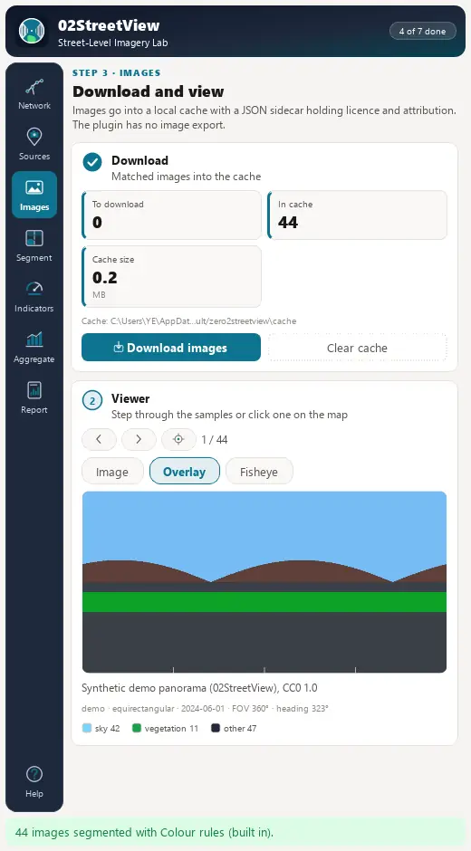
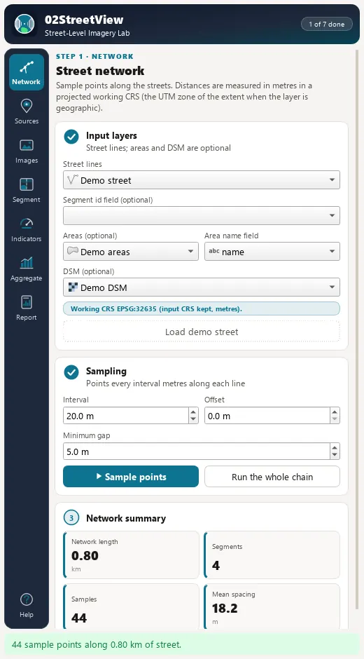
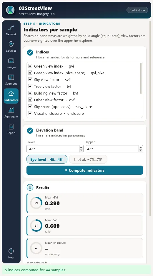
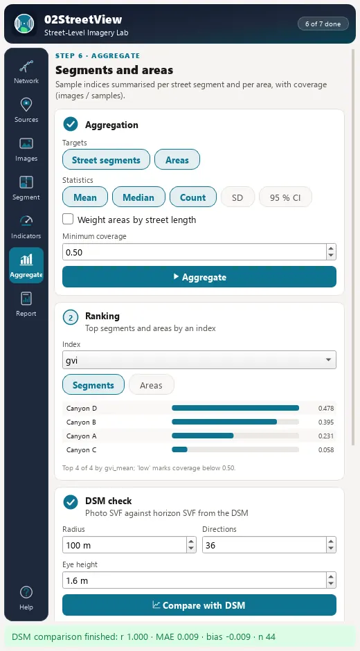
Processing provider
The plugin registers a 02StreetView provider with 10 algorithms in the Processing Toolbox, usable in models, batch mode and scripts.
| Group | Algorithm |
|---|---|
| Demo | Create demo street |
| Sampling | Sample street network |
| Imagery | Search and match images |
| Imagery | Download images to the cache |
| Segmentation | Segment images |
| Indicators | Compute view indicators |
| Aggregation | Aggregate to street segments |
| Aggregation | Aggregate to areas |
| DSM check | DSM check of photo sky view factor |
| Lab | Street-level imagery lab (whole chain) |
Full manual
02StreetView manual
Every page and parameter, methods and formulas, output fields, the worked demo example, limitations and references.
Citation and licence
| Name | 02StreetView - Street-Level Imagery Lab |
| Package | zero2streetview |
| Version | 0.1.0 |
| QGIS | 3.28 or newer; QGIS 4 supported |
| Licence | GPL-2.0-or-later (LICENSE) |
| Developer | Geophilo · Yusuf Eminoğlu (ORCID 0009-0005-6000-2934) |
| Source | gitlab.com/geophilo1/zero2streetview |
| Issues | gitlab.com/geophilo1/zero2streetview/-/work_items |
| Hub | plugins.qgis.org search: zero2streetview (listing pending) |
| Revision | November 2026 |
Eminoğlu, Y. (2026). 02StreetView - Street-Level Imagery Lab (version 0.1.0) [QGIS plugin]. https://gitlab.com/geophilo1/zero2streetview